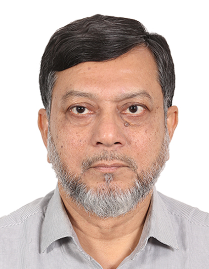
Md. Shahidul Islam
Lead Trainer
A renowned RS & GIS professional in Bangladesh, highly experienced in Remote Sensing (RS), Geographic Information Systems (GIS), Web-GIS Programming, Disaster Management, Physical Infrastructure Planning, Design & Construction, Project and Programme Management, Policy Development, Agricultural Value Chains, Monitoring & Evaluation, Spatial and Non-Spatial Database Development, Web/Desktop/Mobile Software Development, LAN Administration, university-level teaching, and training facilitation. Holds a Master of Engineering in Remote Sensing and GIS from the Asian Institute of Technology, Thailand, a Post Graduate Diploma in RS/GIS from the UN-affiliated Centre for Space Science and Technology Education in Asia and the Pacific (CSSTE-AP), IIRS, Dehradun, India, and a Bachelor of Science in Civil Engineering from Bangladesh University of Engineering and Technology (BUET). Has more than 34 years of multidisciplinary experience across national, international, and development-partner organizations — including the Local Government Engineering Department (LGED) as Civil Engineer/RS-GIS Manager, UNDP as GIS Database Specialist, USAID as Senior Mission GIS Specialist, Development Alternatives Inc. (DAI) as GIS Specialist, the Asian Institute of Technology as Project Researcher, and the University of Dhaka as Assistant Professor. Experienced in GIS data capture using GPS, satellite, and drone imagery; GIS-based urban and rural planning; Web-GIS vehicle tracking; road safety and disaster-incidence database systems; earthquake micro-zonation mapping; and building-inventory field data collection. Proficient across ArcGIS/ArcGIS Pro, ArcGIS Server, QGIS, ArcGIS Dashboard, GeoServer, PostgreSQL/PostGIS, ArcGIS Field Maps, QField, ArcGIS Survey123, KoboToolbox, Google Maps/Earth, Erdas Imagine, ENVI, Tableau, Python, R, SPSS, Leaflet/OpenLayers, JavaScript, HTML, CSS, PHP, Ionic, Shiny, and Linux, with a strong interest in IoT for urban weather monitoring, disaster management, and agriculture.

Md. Khyer Ali
Trainer
A renowned RS & GIS professional in Bangladesh, highly experienced in Remote Sensing (RS), Geographic Information Systems (GIS), Web-GIS Programming, and Spatial/Non-Spatial Database Development. Holds a Master of Geography and Environmental Studies and a Post Graduate Certificate in GIS with specialization in GPS and Remote Sensing, Mapping, and Computer Cartography from Rajshahi University, Bangladesh. Has more than 23 years of multidisciplinary experience with national and development-partner organizations, including the Local Government Engineering Department (LGED) as GIS Specialist (Consultant), UNDP as Short-Term National GIS Consultant, Hifab International AB as Land Acquisition & Mapping Expert, the Sundarbans Environmental and Livelihood Security (SEALS) Project, the Forest Department as GIS Expert Consultant, the JICA Expert Team, Dhaka City Corporation as GIS Specialist Consultant, and Family Health International (FHI) as GIS Specialist Consultant. Experienced in GIS data capture using GPS, satellite, and drone imagery (drone survey processing, DroneDeploy mapping, UAS Master, Summit Evolution), GIS-based urban and rural planning, and building-inventory field data collection. Proficient across ArcGIS/ArcGIS Pro, QGIS, ArcGIS Server, Enterprise Geodatabase, GeoServer, CityEngine, ArcGIS Field Maps, QField, ArcGIS Survey123, KoboToolbox, Google Maps/Earth, Erdas Imagine, ENVI, Leaflet/OpenLayers, JavaScript, HTML, CSS, Enterprise PostgreSQL/PostGIS, MySQL, and PHP, with a strong interest in utility networks, network analysis, linear referencing, and land acquisition planning.